District Profile
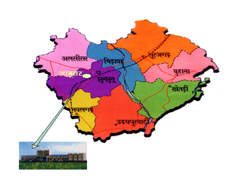
Map of Jhunjhunu District Showing KVK Location
District profile of Jhunjhunu
Jhunjhunu district is irregular hexagonal in shape situated between the 270’38’and 280’31’ N Latitudes and 750’2’ to 760’6’ E Longitudes. It is surrounded buChuru district in the north west side, Hissar and Mahendragarh district of Haryana in the north east, Sikar district in the south and south eastern part.
Administrative Set Up & Demographic Features
| Particulars | No. |
|---|---|
| Panchayat Samities | 08 |
| Tehsils | 08 |
| Sub Divisions | 08 |
| Gram Panchayats | 288 |
| Villages | 927 |
| Nagar Parishad | 01 |
| Nagar Palika | 11 |
| Total Population | 2137045 |
| Male | 1095896 |
| Female | 1041149 |
| Rural | 1647966 |
| Urban | 489079 |
| SC Population | 360709 |
| ST Population | 41629 |
| Sex Ratio | 950 |
| Population Density | 361 |
Description of Agro-climatic Zone & major agro ecological situations (based on soil and topography)
|
S. No |
Agro-climatic Zone |
Characteristics |
|
1 |
Transitional plain of inland drainage zone-II (a) |
|
Soil type/s
|
S. No |
Soil type |
Characteristics |
Area in ha |
|
1 |
Desert soil |
Occurs extensively in the central part of the area covering parts of all the blocks except Surajgarh block.These are yellowish brown, sandy to sandy loam, loose, structure less, well drained with high permeability. They are scanty of vegetation due to severe wind erosion and wind velocity high. |
266600 |
|
2 |
Sand dunes |
Present mostly in northern part of the district covering parts of Alsisar, Buhana, and Chirawa blocks.These are noncalcareous soils, sandy to loamy sand, loose, structureless and well drained.In favourable localities they cultivated. |
214900 |
|
3 |
Red desertic soil |
Rests in parts of Jhunjhunu and Nawalgarh blocks. These are pale brown to reddish brown colour, structureless, loose and well drained having texture from sandy loam to sandy clay loam. Suitable for agriculture but suffers from adverse climatic conditions. |
46800 |
|
4 |
Lithosols and regisols of hills |
Found on Delhi hills and hill slopes between Khetri and Gudagaurji and south of Udaipurwati in parts of Khetri and Udaipurwati and Nawalgarh blocks. They are shallow with gravels very near the surface, light textured, fairly drained, reddish brown to grayish brown in colour. Cultivation is restricted because of limited root zone. |
32900 |
|
5 |
Older alluvium |
Found in southern most parts of the area in parts of Khetri, Udaipurwati and Nawalgarh blocks. They are derived from alluvium and are non-calcareous, semi-consolidated to unconsolidated brown soils, loamy sand to sandy loam in texture. Well drained and occupy gently sloping terrains. |
31600 |
Area, Production and Productivity of major crops cultivated in the district
|
S. No |
Crop |
Area (ha) |
Production (MT) |
Productivity (Qt. /ha) |
|
1 |
Wheat |
88000 |
299200 |
34.00 |
|
2 |
Barley |
12100 |
37510 |
31.05 |
|
3 |
Chick pea |
76983 |
93750 |
12.50 |
|
4 |
Mustard |
72000 |
86400 |
12.00 |
|
5 |
Bajra |
180688 |
162632 |
9.00 |
|
6 |
Green gram |
60646 |
27290 |
4.50 |
|
7 |
Cow pea |
37135 |
18983 |
4.0 |
|
8 |
Cluster bean |
47458 |
34967 |
8.00 |